On the recent trip to Apollo Bay we explored a few spots along Cape Otway including the Cape and Lighthouse area. The road leading into the lighthouse park passed through a Manna Gum forest full of Koalas. Of course we had to stop and take a few shots. Never pass up a chance to photograph an animal that barely moves…

Koala, Cape Otway, Great Otway National Park

A large male Koala reaching for a snack

Koala and joey

II

It has been a hard day…

III
One of the sites I visited a few times was the Old Hordern Vale Road, a dirt road winding up into the local hills behind the Apollo Bay township. It is a good spot to find the white morph Grey Goshawk (which I did get to see – lifer!). At the end of the road amongst a few empty weekenders and a forest of very tall Mountain Ash Gums I found the old Cobb and Co coach road. The old track winds around the Mountain Ash ridges and rainforest gullies and finally comes out several kilometres away, re-connecting to a weekender road and back onto the main highway. Along the way I found a good variety of bird species, more Koalas, and some pretty spectacular trees. Definitely a spot I will return to on future trips to the region.
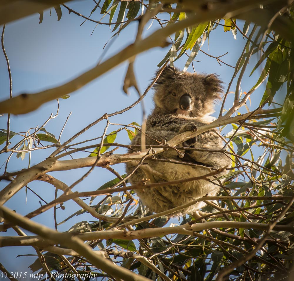
Koala, Old Hordern Vale Rd, Apollo Bay

The old Cobb and Co coach road – now a nice wide trail leading into and around the local hills.

A large gum tree, Old Hordern Vale Rd, Apollo Bay

Great Koala pics! The Koala in the first photo seems to be Meditating 🙂
LikeLike
Thanks for these, fascinating to see so many koalas. Pretty mangy bunch they are though. And the Cobb and Co track, not much left of it. I wonder how much history is right there in plain view and we just don’t recognise it for what it is.
LikeLike
Thanks for the comments Sue, the koalas seemed in OK shape to me, many have been removed now due to over population. The Cobb and Co trail was very interesting…I love finding old signs of our past. The trail would have been hard for the horses, it was quite steep in places. There must be many of these old roads still around. They would be interesting to map out and explore.
LikeLike
There’s a very old track near Braidwood in NSW, the Corn Trail, http://www.nationalparks.nsw.gov.au/things-to-do/Horse-riding-trails/Corn-Trail-walking-track.
This was a route between the plateau to the coast before there were any roads. I was researching this for a book. Also fascinating, old road patterns overlaid with new ones around Canberra. Pre-Canberra there was a lattice of roads, with each town being connected to every other town, but the lattice has been overdrawn with a hub design, all the roads go to the centre. Even out west where I live now, the old roads are still there. Tend to be called things like “Old Gundagai Road” or “Old Narrandera Road”. I suspect I’m a frustrated geographer, Google Maps is now my friend.
LikeLike
That is very interesting Sue, I will have to check it out. I am heading bush this weekend for a week, I will have to look out for the old roads in the Mallacoota area
LikeLike
There must be plenty there, first Indigenous people’s routes and then loggers and European settlers, often old industries we don’t have any more. Industrial archeology and historical geography, munged disciplines. Or perhaps cross-over disciplines is more correct 🙂
LikeLike